Geographic Information Systems (GIS)
Course Description
This comprehensive 5-day course is designed to provide an in-depth introduction to Geographic Information Systems (GIS), a technology that enables the capture, analysis, and visualization of spatial data. clients will learn fundamental concepts, tools, and techniques used in GIS to solve real-world spatial problems across various domains. LPC provides this course to offer you a unique opportunity to learn this system. Geographic Information Systems (GIS) have become indispensable tools for understanding the complex interplay between geography and data. This course serves as a comprehensive initiation into the world of GIS, equipping students with the skills to harness spatial information for analysis, visualization, and problem-solving across diverse domains.
The Training Course Will Highlight ?
Training Objective

In this course, you will embark on a journey to master GIS fundamentals, navigate cutting-edge software, and apply spatial thinking to real-world scenarios. By the course's conclusion, you will be able to:

  • Conceptualize GIS: Understand the core principles underlying GIS technology, its historical development, and its role in transforming data into actionable insights.
  • Manipulate Spatial Data: Confidently work with various types of spatial data, whether vector or raster, and navigate the intricacies of geographic coordinate systems and projections.
  • Operate GIS Software: Proficiently use industry-standard GIS software, such as ArcGIS and QGIS, to create, edit, and manage spatial datasets.
  • Conduct Spatial Analysis: Utilize spatial queries, geoprocessing tools, and overlay techniques to extract meaningful patterns and relationships from geographic data.
  • Craft Informative Maps: Apply cartographic principles to design visually compelling maps, incorporating effective symbolization, labeling, and layout.
  • Apply GIS Across Domains: Explore applications of GIS in urban planning, environmental management, transportation, public health, and more, understanding how spatial analysis empowers decision-making.
  • Navigate Ethical Complexities: Navigate the ethical and legal considerations surrounding spatial data use, ensuring respect for privacy, intellectual property, and responsible data handling.H. Explore sustainable practices and environmental considerations, preparing participants for responsible hydrocarbon operations in the long term.

Target Audience

  • Professionals: Urban planners, environmental consultants, public health officials, and others working with spatial data.
  • Researchers: Those conducting research in social sciences, natural sciences, and public health requiring spatial analysis.
  • Educators: Teachers aiming to integrate GIS technology into their teaching methods for conveying spatial concepts.
  • Individuals fascinated by geography, maps, and data analysis, regardless of formal career paths.
  • Government Employees: City planners, disaster management personnel, and others in government roles involving spatial information.
  • NGO Workers: Employees of non-governmental organizations focused on environmental conservation, social justice, and community development.
  • Entrepreneurs: Business owners seeking to leverage spatial data for location-based services and market analysis.

Training Methods

Daily Agenda

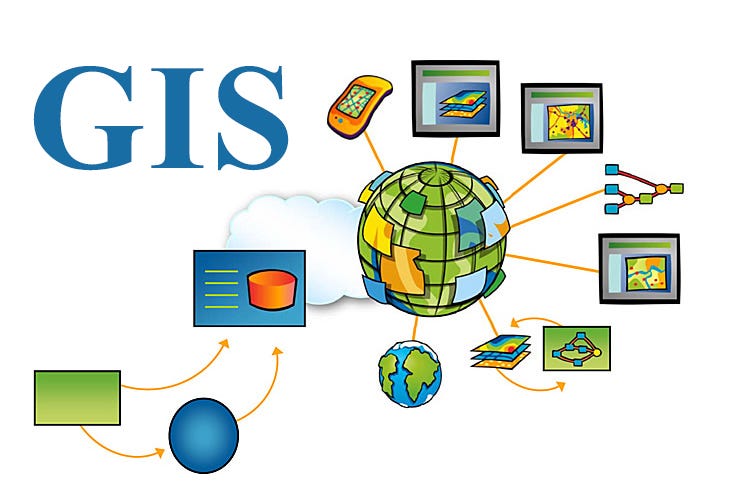
Day 1: Introduction to GIS , Spatial Data Sources and Data Models

  • Understanding spatial data and its importance
  • History and evolution of GIS technology
  • Components of GIS: hardware, software, data, people, methods
  • Types of spatial data: vector vs. raster
  • Data acquisition methods: GPS, remote sensing, surveys
  • Coordinate systems and projections
  • Attribute data and relational databases

Day 2: GIS Software and Tools

  • Introduction to popular GIS software (e.g., ArcGIS, QGIS)
  • User interface and basic operations
  • Data input, editing, and manipulation

Day 3: Spatial Analysis

  • Spatial queries and selection
  • Geoprocessing: buffering, clipping, merging
  • Spatial analysis techniques: overlay, proximity analysis
  • Collect, manage, and analyze spatial data using GIS software

Day 4: Cartography and Map Design

  • Principles of cartography
  • Creating effective and informative maps
  • Symbolization, labeling, and map layout
  • Understanding color theory and its implications for map readability.
  • Using color effectively to represent data categories, gradients, and patterns.
  • Considering colorblind-friendly palettes to ensure inclusivity.

Day 5: Applications of GIS, Ethical and Legal Considerations in GIS

  • Urban planning and land management
  • Environmental analysis and natural resource management
  • Transportation and logistics
  • Epidemiology and public health
  • Privacy concerns and data security
  • Intellectual property and copyright
  • Ethical use of spatial data
  • Case studies and real-world examples
Accreditation

RECTUS attendance certificate will be issued to all attendees completing minimum of 80% of the total course duration

Quick Enquiry

Request Info

Download Brochure Request In house Proposal

Course Rounds : (5 -Days)


Code Date Venue Fees Register
CCE107-02 18-05-2025 Dubai USD 5450
CCE107-03 18-08-2025 Zürich USD 6950
CCE107-04 16-11-2025 Dubai USD 5450
Prices doesn't include VAT

UpComing Date


Details
  • Start date 18-05-2025
  • End date 22-05-2025

Venue
  • Country UAE
  • Venue Dubai

Quality Policy

 Providing services with a high quality that are satisfying the requirements
 Appling the specifications and legalizations to ensure the quality of service.
 Best utilization of resources for continually improving the business activities.

Technical Team

BTS keen to selects highly technical instructors based on professional field experience

Strengths and capabilities

Since BTS was established, it considered a training partner for world class oil & gas institution

Search For Available Course

Abu Dhabi, UAE

1st floor, Incubator Building- Masdar City - Abu Dhabi - United Arab Emirates

00971-2-5757062

Sun to Fri 09:00 AM to 06:00 PM

info@rectustraining.com

Contact Us anytime!